Public Rights of Way
Little Clacton has a fair amount of footpaths and bridleways and in 2003 a new bridleway was made around Street Farm. This bridleway was extended into Holland Road at the beginning of 2005 giving another entrance. Most footpaths are cut once a year as it is assumed that walkers and riders clear them with use. So carry on walking.
| PROW Id | Type | Description |
| 2 | Footpath | From Harwich Road (midway between Blairment and Woodlands) in a northerly direction to the parish boundary with Weeley where it continues as footpath 8 |
| 3 | Footpath | From Tan Lane leading north-westwards and south-westwards for approximately 359 metres along and inside the northern boundary of Clacton Grove House. This section of the path has a width of 2 metres. Then, with unspecified width, continuing westwards a |
| 4 | Footpath | From Dead Lane leading south-westwards, then north-westwards, then south-westwards to the A133 Lt Clacton & Weeley Heath Bypass |
| 5 | Footpath | From Little Clacton village, opposite St James Church, leading eastwards to meet BR7 and continuing north-eastwards to Tan Lane |
| 7 | Bridleway | From Holland Road leading north-westwards for approximately 190mt, along the eastern boundary of OS field 1600, to meet FP5 and BR21. Width is 3mt. |
| 8 | Footpath | From Dead Lane, north of Gidea Hall in a westerly direction through Hartley Grove to the parish boundary with St Osyth where it continues as footpath 12. |
| 10 | Bridleway | Lodge Road. From Thorpe Road south of Ricebridge Cottages, south-east via Little Clacton Lodge to road north of Dairy House. |
| 11 | Footpath | From Colchester Road opposite Colston Lodge, north-west along Homing Road and to Thorrington Road. |
| 12 | Bridleway | (Honeypot Lane) From the Colchester Road at the parish boundary (north-west of Rosedale) south-west along the parish boundary to join BR23 in St Osyth Parish. |
| 13 | Bridleway | From the main road near the Methodist Chapel , in a southerly direction for about 350 feet. |
| 15 | Bridleway | From Cooks Farm in a southerly direction to Urban District Boundary. |
| 16 | Footpath | From the A133 Lt Clacton & Weeley Heath Bypass leading north-westwards to the parish boundary where it continues as FP14 in St Osyth |
| 17 | Footpath | 32mt of footpath, leading south-westwards from the A133 along the stopped-up section of Dead Lane, to the ford over Pickers Ditch. |
| 18 | Footpath | 1 metre strip of footpath rights only, separating the eastern section of Dead Lane and BR19 from the A133 |
| 19 | Bridleway | From Dead Lane leading south-eastwards along the eastern side of the A133 to St Osyth Road. |
| 20 | Footpath | A footpath over the pedestrian footbridge, across the A133, linking the two sections of St Osyth Road. |
| 21 | Bridleway | From The Street leading north-eastwards for approximately 504 metres to meet FP3. Then generally south-eastwards for approximately 805 metres along eastern boundaries of fields. Then south-westwards for approximately 566 metres along southern boundary |
"Definitive Map of Public Rights of Way for the County of Essex"
This document is a paper item held by the County Council with various bodies around the County, including Parish, and other, Councils holding a copy for local reference. The 'original' copy held by the County Council is the legally definitive record. This arrangement, on its own, did not form an entirely convenient arrangement for the usual purposes of walkers and other users of the public rights of way seeking information on where public footpaths exist, where they lead and how they are connected into the wider picture.
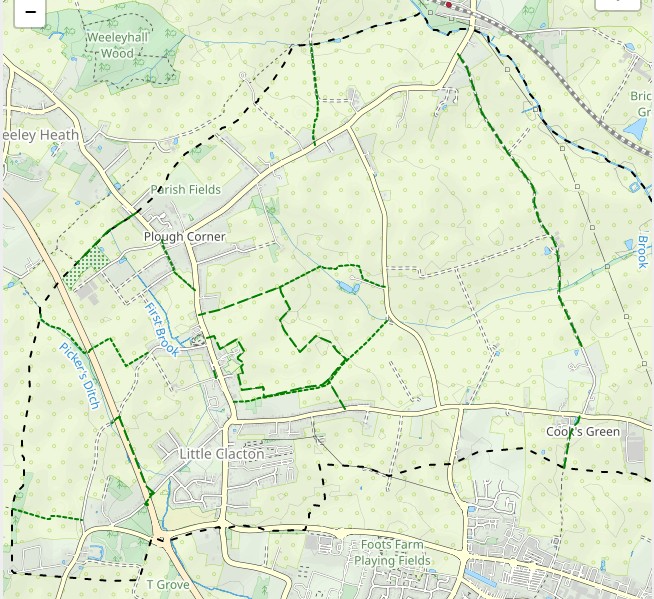
https://www.essexhighways.org/getting-around/public-rights-of-way/prow-interactive-map